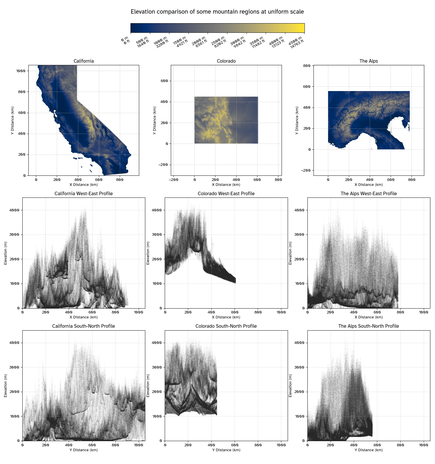
Elevation Visualizations of California and Colorado
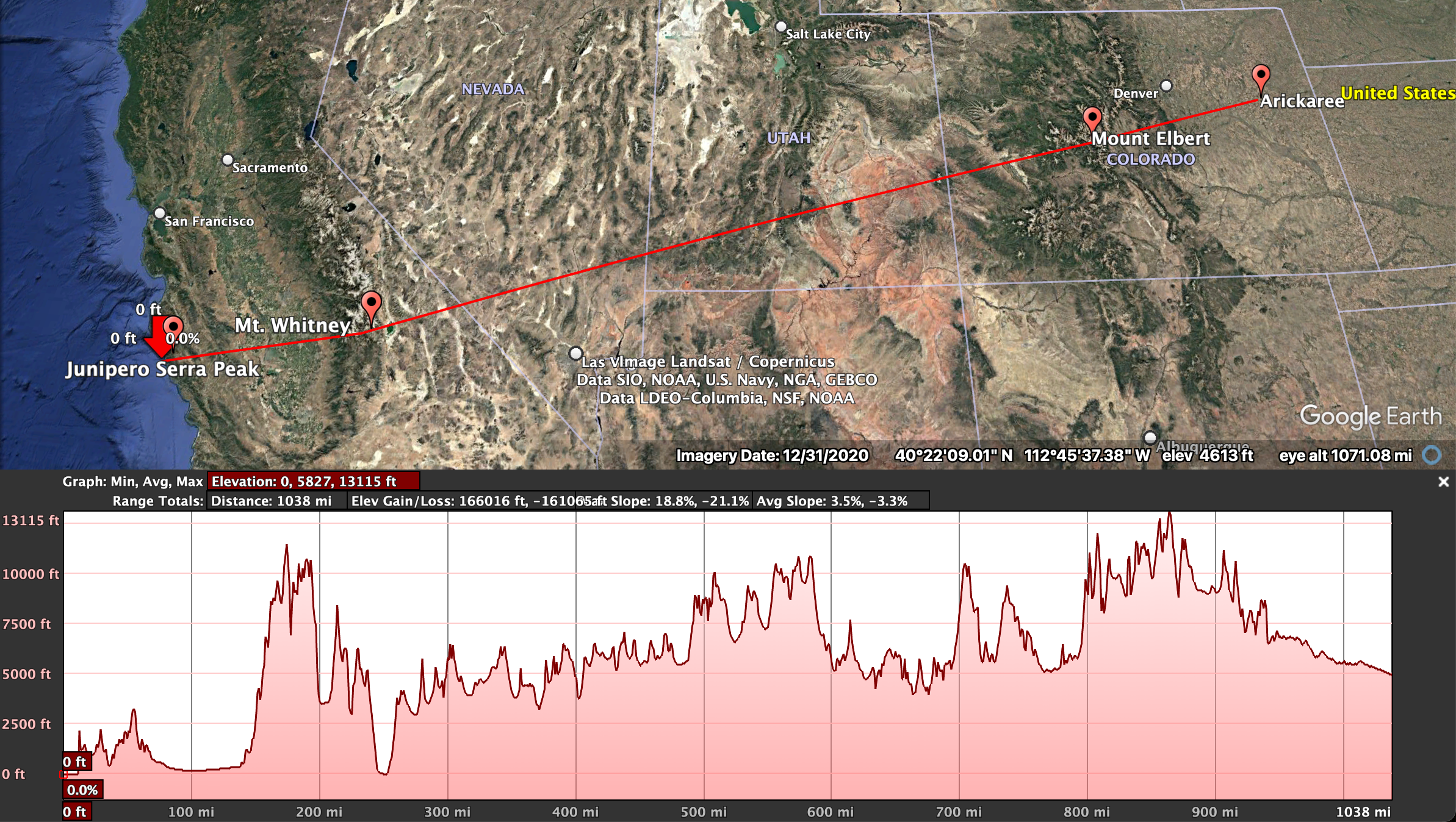
On a recent visit to the Rocky Mountains, I was struck by the quintessential triangles of the distinct peaks surrounding me. And upon uncovering the factoid that California hosts both the highest point in the continuous United States and the lowest point in North America a mere 130 kilometers (85 miles) away, I had to bring the two states next to each other for comparison. Mount Whitney at 4,421 meters (14,505 feet) exceeds the Coloradan Mount Elbert by only 21 meters (65 feet)!
I downloaded GMTED2010 30 arc-second resolution elevation data from the USGS EROS Archive via EarthExplorer, I also threw in the Alps while I was at it. I tried Alaska and the Tibetan Plateau too, but they just blow the rest out of the water to meaningfully compare.
My first attempt was using Google Earth. I find the dip of Badwater Basin (home of Death Valley) striking. Here’s a screenshot from that proof of concept: